
Data: state (PLAYER_GPS_DATA_STATE) More...
#include <player_interfaces.h>
Detailed Description
Data: state (PLAYER_GPS_DATA_STATE)
The gps interface gives current global position and heading information.
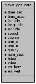
Public Attributes | |
| uint32_t | time_sec |
| GPS (UTC) time, in seconds and microseconds since the epoch. More... | |
| uint32_t | time_usec |
| GPS (UTC) time, in seconds and microseconds since the epoch. More... | |
| int32_t | latitude |
| Latitude in degrees / 1e7 (units are scaled such that the effective resolution is roughly 1cm). More... | |
| int32_t | longitude |
| Longitude in degrees / 1e7 (units are scaled such that the effective resolution is roughly 1cm). More... | |
| int32_t | altitude |
| Altitude, in millimeters. More... | |
| double | speed |
| Speed over ground, in meters/second . More... | |
| double | course |
| Course made good (heading if the robot moves along its longitudinal axis), in radians. More... | |
| double | utm_e |
| UTM WGS84 coordinates, easting [m]. | |
| double | utm_n |
| UTM WGS84 coordinates, northing [m]. | |
| uint32_t | quality |
| Quality of fix 0 = invalid, 1 = GPS fix, 2 = DGPS fix. | |
| uint32_t | num_sats |
| Number of satellites in view. More... | |
| uint32_t | hdop |
| Horizontal dilution of position (HDOP), times 10. | |
| uint32_t | vdop |
| Vertical dilution of position (VDOP), times 10. | |
| double | err_horz |
| Horizonal error [m]. | |
| double | err_vert |
| Vertical error [m]. | |
Member Data Documentation
◆ altitude
| int32_t player_gps_data::altitude |
Altitude, in millimeters.
Positive is above reference (e.g., sea-level), and negative is below.
◆ course
| double player_gps_data::course |
Course made good (heading if the robot moves along its longitudinal axis), in radians.
◆ latitude
| int32_t player_gps_data::latitude |
Latitude in degrees / 1e7 (units are scaled such that the effective resolution is roughly 1cm).
Positive is north of equator, negative is south of equator.
◆ longitude
| int32_t player_gps_data::longitude |
Longitude in degrees / 1e7 (units are scaled such that the effective resolution is roughly 1cm).
Positive is east of prime meridian, negative is west of prime meridian.
◆ num_sats
| uint32_t player_gps_data::num_sats |
Number of satellites in view.
◆ speed
| double player_gps_data::speed |
Speed over ground, in meters/second .
◆ time_sec
| uint32_t player_gps_data::time_sec |
GPS (UTC) time, in seconds and microseconds since the epoch.
◆ time_usec
| uint32_t player_gps_data::time_usec |
GPS (UTC) time, in seconds and microseconds since the epoch.
The documentation for this struct was generated from the following file:
Generated on Wed Sep 2 2020 16:39:29 for Player by
 1.8.13