Garmin GPS
[Models]

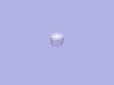
The GarminGPS model simulates GPS information by using the flat-world approximation. It doesn't account for GPS occlusion or loss of signal, etc.
When using the GPS modle, one must also define a UTM offset and zone in the global parameters section of the world file. The UTM offset governs the transformation between simulation coordinates and UTM coordinates; i.e., the point (0, 0, 0) in the simulation frame is mapped to point (utmOffset.x, utmOffset.y, utmOffset.z) in the UTM frame. The UTM zone is used to convert UTM coordinates to latitude and longitude.
- libgazebo interfaces
- Player drivers
- Attributes
- id (string)
- The model ID string (used by libgazebo to identify models).
- Default: (empty)
- xyz (float tuple, meters)
- Model position (x, y, z, in meters).
- Default: 0 0 0
- rpy (float tuple, degrees)
- Model orientation in Euler angles: roll, pitch, yaw.
- Default: 0 0 0
- gravity (bool)
- Enable/disable effect of gravity on this model
- Default: true
- enable (bool)
- Enable/disable the model's bodies (so it doesn't fall, for example)
- Default: true
- Bodies
- canonical
- The canonical (default) body.
- Example
<model:GarminGPS>
  <id>gps1</id>
</model:GarminGPS>
- Todo:
- Horizontal and vertical errors (Garmin specific).
Model satellite geometry for DOP.
Compute satellite occlusions.
- Views
 |
 |
||
 |
 |
 |
 |
 |
- Authors
